
This map visualizes occurrence records of Lontra (otters) across Mexico using data from the Global Biodiversity Information Facility (GBIF.org, accessed February 9, 2026, https://doi.org/10.15468/dl.2unec7). The heat map, created in ArcGIS, displays density patterns of otter observations from museum specimens, research surveys, and citizen science contributions.
Areas of lighter intensity indicate higher concentrations of recorded sightings, revealing distribution hotspots across Mexican ecosystems while also highlighting regions where data may be limited
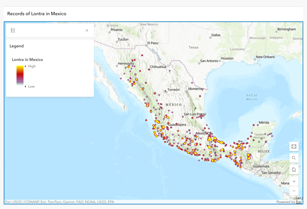
GBIF.org (09 February 2026) GBIF Occurrence Download https://doi.org/10.15468/dl.2unec7

Leave a comment